

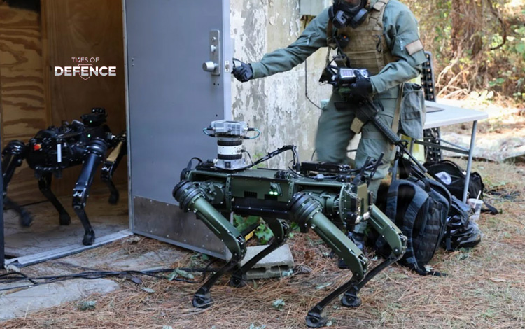
KIRTLAND AFB / CENTERVILLE — The Defense Threat Reduction Agency (DTRA) has issued a sole-source procurement notice to award a firm-fixed-price contract to Rocky Mountain Unmanned Systems (RMUS). The program targets the development of an autonomous quadrupedal Unmanned Ground Vehicle (UGV) prototype capable of real-time 3D spatial mapping and hazardous atmospheric gas detection in contested chemical, biological, radiological, and nuclear (CBRN) environments.
The effort, managed by DTRA’s Western Contracting Office, focuses on multi-sensor data fusion. RMUS will integrate a government-furnished multi-gas chemical detector, a survey-grade 3D LiDAR unit, a commercial off-the-shelf quadruped platform, and a tactical ad-hoc mesh networking radio. Proprietary data-fusion software will synthesize sensor telemetry to generate live, volumetric 3D hazardous atmosphere maps, allowing CBRN reconnaissance teams to conduct standoff threat assessments without exposing human personnel to toxic environments.
TECHNICAL SPECIFICATIONS: DTRA / RMUS CBRN QUADRUPED PROTOTYPE 
* System Classification: Autonomous CBRN Reconnaissance & Volumetric Gas Mapping Quadruped UGV
* Procuring Agency: Defense Threat Reduction Agency (DTRA / U.S. Department of War)
* System Integrator: Rocky Mountain Unmanned Systems (RMUS)
* Primary Mission Set: Stand-off CBRN hazard detection, volumetric gas plume 3D mapping, and urban/subterranean structural reconnaissance
* Platform Architecture & Mobility:
* Base Platform: Commercial Off-The-Shelf (COTS) Quadruped Unmanned Ground Vehicle (e.g., Ghost Robotics Vision 60 / Boston Dynamics Spot class)
* Terrain Capability: Multi-terrain capability (stairs, rubble, confined subterranean structures, and obstacle traversal)
* Payload & Sensor Integration Architecture:
* Chemical Detection Suite: Government-Furnished Equipment (GFE) multi-gas chemical detector array
* Spatial Mapping Sensor: High-precision survey-grade 3D LiDAR scanner
* Data Fusion Software: RMUS proprietary software framework converting spatial LiDAR point clouds and chemical concentration telemetry into real-time 3D hazard maps
* Communications Link: Mobile Ad-Hoc Network (MANET) tactical mesh radio for real-time telemetry streaming in Non-Line-Of-Sight (NLOS) and degraded environments
* Operational Impact:
* Real-time 3D volumetric mapping of toxic industrial chemicals (TICs) and chemical warfare agents (CWAs)
* Eliminates human entry requirements into unverified, high-risk chemical or radiological threat zones
* Provides command nodes with actionable spatial overlay of contamination plumes